
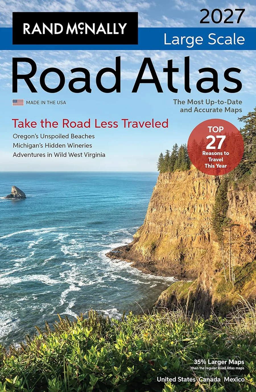
Rand McNally 2027 Large Scale Road Atlas
Paperback
• 304 Pages
• USD 32.99
• English
• 9780528029509
No ratings yet
| Publisher | Rand McNally |
|---|---|
| ISBN13 | 9780528029509 |
| ASIN/SKU | 0528029509 |
| Book Format | Paperback |
| Language | English |
| Pages | 304 |
| List Price | USD 32.99 |
| Publishing Date | 13/04/2026 |
| Dimensions | 10 x 0.8 x 15.2 inches |
| Weight | 2.75 pounds |
| Book Code | BD00054648 |
Buy this Book
Amazon Stores
Ebook Stores
Other Stores
Discover Rand McNally 2027 Large Scale Road Atlas by Rand McNally. This book is published by Rand McNally in Paperback format, ISBN 9780528029509, ASIN 0528029509, under Travel, Transportation, Reference.
Book Description
Rand McNally 2027 Large Scale Road Atlas
35% Larger Maps Than the Regular Road Atlas
If having the most up to date and accurate maps developed by the #1 map company are important to you, then Rand McNally is your only choice. We have a 150+ year history of providing not just road and route guidance, but detailed information about states, points of interest, historic sites, and much more. Plus, this updated edition is packed with fresh reasons to pack the car and go this year!
27 Reasons to Hit the Road: Navigating America's Biggest Year Yet
Between the FIFA World Cup turning cities into international festivals and America250 turning our historic corridors into living museums, the roads will be humming with energy in 2026. For the road-tripper, this means our national arteries--such as the legendary Route 66, which turns 100 this year--will be the front row to a yearlong celebration. Whether you are chasing the roar of a stadium or the quiet dignity of a new presidential library in the Badlands, we'll share all the reasons why this is the year to plan your all-American road trip.
Secret Escapes: 7 Stunning Detours for a Smarter Road Trip
Experience the joy of the "road trip dupe"--trading the tourist track for a pace that lets you slow down. Instead of the chaos of major hubs, discover the wild reaches of West Virginia, western Colorado or the hidden side of the Alabama Gulf Coast. By leaning into these off-peak windows, you trade long lines for serene vistas and soul-stirring beauty that feels entirely your own.
The Journey Continues
Ready to hit the road? Scan the included QR codes on our seven road trip itineraries for more hidden gems, expert travel hacks and the perfect soundtrack for your trip.
Why Choose Rand McNally Over the Competition?
Always Up-to-Date
Updated annually - unlike competitors who update only 2-3 years or more.
Larger, More Readable Maps
State maps are 35% larger than our regular Road Atlas and up to 170% larger than the competitor for easier navigation and planning.
80% More Pages
304 pages vs. just 169 pages of a distant competitor- offering easier to read maps with more map detail, more destinations, and more travel insight.
More City Inset Maps
378 detailed city insets vs. 345 - nearly 10% more.
Brand-New Editorial Content
16 pages of our editors' pics for best travel experiences updated annually - not a rerun of past content.
Expertly Crafted Maps
Created by our in-house cartographic team in Chicago vs. third party outsourced by competitors.
Easier on the Eyes
Clean white backgrounds and vibrant, user-friendly color palette vs. darker, less readable designs.
Travel Planning Information
Tourism, construction, and toll info for each U.S. state and Canadian province.
QR Codes for Each Trip and on Each State Map Page
Provides info on more hidden gems, expert travel tips, and tourism information.
Page Locater Map
Quick and easy access to the map you need.
35% Larger Maps Than the Regular Road Atlas
If having the most up to date and accurate maps developed by the #1 map company are important to you, then Rand McNally is your only choice. We have a 150+ year history of providing not just road and route guidance, but detailed information about states, points of interest, historic sites, and much more. Plus, this updated edition is packed with fresh reasons to pack the car and go this year!
27 Reasons to Hit the Road: Navigating America's Biggest Year Yet
Between the FIFA World Cup turning cities into international festivals and America250 turning our historic corridors into living museums, the roads will be humming with energy in 2026. For the road-tripper, this means our national arteries--such as the legendary Route 66, which turns 100 this year--will be the front row to a yearlong celebration. Whether you are chasing the roar of a stadium or the quiet dignity of a new presidential library in the Badlands, we'll share all the reasons why this is the year to plan your all-American road trip.
Secret Escapes: 7 Stunning Detours for a Smarter Road Trip
Experience the joy of the "road trip dupe"--trading the tourist track for a pace that lets you slow down. Instead of the chaos of major hubs, discover the wild reaches of West Virginia, western Colorado or the hidden side of the Alabama Gulf Coast. By leaning into these off-peak windows, you trade long lines for serene vistas and soul-stirring beauty that feels entirely your own.
The Journey Continues
Ready to hit the road? Scan the included QR codes on our seven road trip itineraries for more hidden gems, expert travel hacks and the perfect soundtrack for your trip.
Why Choose Rand McNally Over the Competition?
Always Up-to-Date
Updated annually - unlike competitors who update only 2-3 years or more.
Larger, More Readable Maps
State maps are 35% larger than our regular Road Atlas and up to 170% larger than the competitor for easier navigation and planning.
80% More Pages
304 pages vs. just 169 pages of a distant competitor- offering easier to read maps with more map detail, more destinations, and more travel insight.
More City Inset Maps
378 detailed city insets vs. 345 - nearly 10% more.
Brand-New Editorial Content
16 pages of our editors' pics for best travel experiences updated annually - not a rerun of past content.
Expertly Crafted Maps
Created by our in-house cartographic team in Chicago vs. third party outsourced by competitors.
Easier on the Eyes
Clean white backgrounds and vibrant, user-friendly color palette vs. darker, less readable designs.
Travel Planning Information
Tourism, construction, and toll info for each U.S. state and Canadian province.
QR Codes for Each Trip and on Each State Map Page
Provides info on more hidden gems, expert travel tips, and tourism information.
Page Locater Map
Quick and easy access to the map you need.
Author Biography
As America’s original mapmaker, Rand McNally has been guiding travelers since 1872.
For more than 150 years, our atlases, wall maps, folded maps, activity books, and other publications have inspired a love of exploration and enriched life’s journeys.
Today, our maps are still proudly crafted by our in-house cartographic team based in the Chicago area. Here's what sets Rand McNally maps apart:
• Made in the USA: The only Road Atlases solely created and printed in the United States.
• Updated Annually: Our Road Atlases are updated every year with the latest road and points of interest revisions.
• Larger Maps: The Large Scale Road Atlas features maps up to 170% larger than the competition.
• More City Insets: Includes more detailed city maps than any other brand, making urban navigation a breeze.
• Easy to Read: Designed for clarity with a clean white background and a vibrant, user-friendly color palette.
Whether you’re hitting the road or planning your next adventure, trust Rand McNally—the name that’s been helping America explore for generations.
For more than 150 years, our atlases, wall maps, folded maps, activity books, and other publications have inspired a love of exploration and enriched life’s journeys.
Today, our maps are still proudly crafted by our in-house cartographic team based in the Chicago area. Here's what sets Rand McNally maps apart:
• Made in the USA: The only Road Atlases solely created and printed in the United States.
• Updated Annually: Our Road Atlases are updated every year with the latest road and points of interest revisions.
• Larger Maps: The Large Scale Road Atlas features maps up to 170% larger than the competition.
• More City Insets: Includes more detailed city maps than any other brand, making urban navigation a breeze.
• Easy to Read: Designed for clarity with a clean white background and a vibrant, user-friendly color palette.
Whether you’re hitting the road or planning your next adventure, trust Rand McNally—the name that’s been helping America explore for generations.
Editorial Reviews
Editorial Reviews will be added soon…
Book Summary
The 2027 edition of the Rand McNally Large Scale Road Atlas stands as a defiant, beautifully crafted testament to the enduring romance of the North American road trip. In an era completely dominated by the glowing blue lines of smartphone GPS applications and dashboard navigation systems, this physical book offers a deeply tangible, uninterrupted connection to the landscape. It is not merely a collection of maps; it is a canvas for adventure, a reliable fail-safe, and a masterclass in modern cartography. While digital navigation is entirely focused on ruthless efficiency—getting a driver from point A to point B as quickly as possible while ignoring the periphery—the Rand McNally atlas invites the reader to truly understand the journey, to visually comprehend the vast spaces between destinations, and to appreciate the sheer, breathtaking scale of the continent.
The most defining feature of this specific edition is its physical construction, which is explicitly designed with the driver's comfort and practical usability in mind. The "Large Scale" designation means that the maps within these pages are printed at a staggering thirty-five percent larger size than the standard Rand McNally atlas. This thoughtful design choice results in significantly larger text and highly magnified details, completely eliminating the need to squint at tiny font sizes while navigating a bouncy RV or sitting in a dimly lit passenger seat. Furthermore, the book utilizes a sturdy, spiral-bound spine. This essential feature allows the heavy atlas to lay completely flat on a center console, a lap, or a steering wheel without the pages frustratingly flipping over or the binding cracking under pressure. It is a piece of analog technology engineered for the rugged reality of the open road, completely immune to cellular dead zones, depleted batteries, and the sudden losses of satellite signal that so often plague digital devices in remote mountainous regions.
Inside its durable covers, the atlas is a meticulously organized, data-rich portrait of the United States, Canada, and Mexico. The states and provinces are arranged alphabetically, each boasting incredibly detailed, full-color maps that highlight the complex vascular system of interstates, federal highways, state routes, and winding rural backroads. What sets the Large Scale edition apart is the immense volume of supplementary detail seamlessly integrated into the cartography. It features over three hundred and fifty detailed city inset maps, allowing drivers to confidently navigate the complex interchanges, ring roads, and bypasses of major metropolitan areas without missing a beat. The iconic Rand McNally legend acts as the essential key to this kingdom, teaching readers how to easily interpret the subtle topographical shading that indicates elevation changes, the distinctly colored highway shields, and the crucially important markers for rest areas, welcome centers, and toll booths.
For the 2027 edition, the cartographers have undertaken their rigorous, annual process of updating the continental grid to ensure maximum reliability. A map is only as valuable as its accuracy, and this volume reflects thousands of meticulously researched updates from the previous year. This includes the integration of newly completed highway construction projects, the addition of fresh interstate bypasses, the shifting status of electronic toll roads, and the renaming of various county routes. Beyond the roads themselves, the atlas serves as a comprehensive travel guide, highlighting thousands of points of interest. It features a dedicated, highly detailed section focused entirely on the National Parks, providing indispensable information for the millions of tourists who flock to these protected lands each year. The classic mileage chart, an indispensable feature that cross-references hundreds of major cities to calculate exact driving distances and estimated travel times, remains a centerpiece of practical, big-picture trip planning.
Ultimately, the Rand McNally 2027 Large Scale Road Atlas represents a fundamentally different philosophy of travel. When a driver enters a destination into a smartphone, the screen zooms in, hiding the rest of the world and reducing the environment to a single, hyper-focused path of least resistance. The physical atlas, however, forces the traveler to look at the entire board. It encourages serendipity and exploration. A driver tracing their route with a finger might suddenly notice a cluster of blue lakes just ten miles off the interstate, or spot the iconic dotted green line that Rand McNally uses to designate exceptionally scenic routes, prompting a spontaneous detour. It transforms the passenger from a passive follower of robotic voice prompts into an active, engaged navigator. In a world of fleeting digital data, this heavy, oversized book becomes a treasured travel companion, often bearing the faded highlighter marks and coffee stains of past journeys, serving as a permanent, physical record of a life well-traveled.
The most defining feature of this specific edition is its physical construction, which is explicitly designed with the driver's comfort and practical usability in mind. The "Large Scale" designation means that the maps within these pages are printed at a staggering thirty-five percent larger size than the standard Rand McNally atlas. This thoughtful design choice results in significantly larger text and highly magnified details, completely eliminating the need to squint at tiny font sizes while navigating a bouncy RV or sitting in a dimly lit passenger seat. Furthermore, the book utilizes a sturdy, spiral-bound spine. This essential feature allows the heavy atlas to lay completely flat on a center console, a lap, or a steering wheel without the pages frustratingly flipping over or the binding cracking under pressure. It is a piece of analog technology engineered for the rugged reality of the open road, completely immune to cellular dead zones, depleted batteries, and the sudden losses of satellite signal that so often plague digital devices in remote mountainous regions.
Inside its durable covers, the atlas is a meticulously organized, data-rich portrait of the United States, Canada, and Mexico. The states and provinces are arranged alphabetically, each boasting incredibly detailed, full-color maps that highlight the complex vascular system of interstates, federal highways, state routes, and winding rural backroads. What sets the Large Scale edition apart is the immense volume of supplementary detail seamlessly integrated into the cartography. It features over three hundred and fifty detailed city inset maps, allowing drivers to confidently navigate the complex interchanges, ring roads, and bypasses of major metropolitan areas without missing a beat. The iconic Rand McNally legend acts as the essential key to this kingdom, teaching readers how to easily interpret the subtle topographical shading that indicates elevation changes, the distinctly colored highway shields, and the crucially important markers for rest areas, welcome centers, and toll booths.
For the 2027 edition, the cartographers have undertaken their rigorous, annual process of updating the continental grid to ensure maximum reliability. A map is only as valuable as its accuracy, and this volume reflects thousands of meticulously researched updates from the previous year. This includes the integration of newly completed highway construction projects, the addition of fresh interstate bypasses, the shifting status of electronic toll roads, and the renaming of various county routes. Beyond the roads themselves, the atlas serves as a comprehensive travel guide, highlighting thousands of points of interest. It features a dedicated, highly detailed section focused entirely on the National Parks, providing indispensable information for the millions of tourists who flock to these protected lands each year. The classic mileage chart, an indispensable feature that cross-references hundreds of major cities to calculate exact driving distances and estimated travel times, remains a centerpiece of practical, big-picture trip planning.
Ultimately, the Rand McNally 2027 Large Scale Road Atlas represents a fundamentally different philosophy of travel. When a driver enters a destination into a smartphone, the screen zooms in, hiding the rest of the world and reducing the environment to a single, hyper-focused path of least resistance. The physical atlas, however, forces the traveler to look at the entire board. It encourages serendipity and exploration. A driver tracing their route with a finger might suddenly notice a cluster of blue lakes just ten miles off the interstate, or spot the iconic dotted green line that Rand McNally uses to designate exceptionally scenic routes, prompting a spontaneous detour. It transforms the passenger from a passive follower of robotic voice prompts into an active, engaged navigator. In a world of fleeting digital data, this heavy, oversized book becomes a treasured travel companion, often bearing the faded highlighter marks and coffee stains of past journeys, serving as a permanent, physical record of a life well-traveled.
Sample Chapters
Sample Chapters will be added soon…
Reader Reviews
No reviews yet.
Rand McNally 2027 Large Scale Road Atlas
Download Cover Image
Do you want to download the full cover image for Rand McNally 2027 Large Scale Road Atlas?