
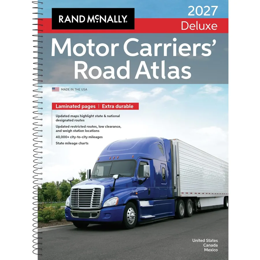
Rand McNally 2027 Deluxe Motor Carriers Road Atlas
Paperback
• 208 Pages
• USD 89.99
• English
• 9780528029554
No ratings yet
| Publisher | Rand McNally |
|---|---|
| ISBN13 | 9780528029554 |
| ASIN/SKU | 052802955X |
| Book Format | Paperback |
| Language | English |
| Pages | 208 |
| List Price | USD 89.99 |
| Publishing Date | 16/06/2026 |
| Dimensions | 11.5 x 0.9 x 15.3 inches |
| Weight | 3.25 pounds |
| Book Code | BD00069738 |
Buy this Book
Amazon Stores
Ebook Stores
Other Stores
Discover Rand McNally 2027 Deluxe Motor Carriers Road Atlas by Rand McNally. This book is published by Rand McNally in Paperback format, ISBN 9780528029554, ASIN 052802955X, under Non Fiction, United States Atlases and Maps, Maps.
Book Description
2027 Deluxe Motor Carriers' Road Atlas
Laminated and spiral bound Motor Carriers' Road Atlas for heavy-duty users
For more than 45 years, the Deluxe Motor Carriers' Road Atlas has earned a permanent place in the cabs of millions of professional drivers. The #1 selling trucker's road atlas in North America is as tough as the rig you're driving, with its laminated pages and spiral binding able to stand up to all the wear-and tear from the road. And, as always, it is produced by Rand McNally professionals and printed in the USA.
The atlas is a trusted source for detailed route planning, a comprehensive big-picture overview, and a dependable backup in the event of GPS outages. This is why the atlas continues to elicit five-star reviews for accuracy, dependability, and ease of use.
Road Specific Updates in the 2027 Edition Include:
Interstate 295: Completed the Fayetteville Outer Loop on the North Carolina map.
Interstates 343 & 644: Added new interstate designations to the Oklahoma map.
Interstate 84 in Connecticut: Updated to reflect mileage-based exit numbers.
U.S. Highway 15: Upgraded to Interstate 99 in Pennsylvania from Williamsport north to the New York State line.
U.S. Highway 395: Added new 4-lane divided highway section west of Olancha, California.
Autoroute 35: New limited access section (Phase 3) added in southern Québec near the Vermont border.
Additional Updated Features:
Fuel Tax Information: Essential for managing fuel expenses and tax reporting.
Tractor/Trailer Inspection Procedures: Ensure compliance with safety standards.
Hazmat Route Regulations: Updated tips, facts, and resources for transporting hazardous materials.
Updated Restricted Routes and Low Clearances: Enhanced details to avoid obstacles and plan safe routes.
Weigh Station Locations: Current information for checking compliance with weight regulations.
Mileage Directory: A 22-page section with over 40,000 truck route-specific, city-to-city mileages.
State and National Route Coverage: Comprehensive details on designated routes.
Product Details
EAN: 9780528029554
SRP: $89.99
Paperback - Spiral Binding
208 Laminated pages
Dimensions: 11 1/4" x 15 3/8"
Laminated and spiral bound Motor Carriers' Road Atlas for heavy-duty users
For more than 45 years, the Deluxe Motor Carriers' Road Atlas has earned a permanent place in the cabs of millions of professional drivers. The #1 selling trucker's road atlas in North America is as tough as the rig you're driving, with its laminated pages and spiral binding able to stand up to all the wear-and tear from the road. And, as always, it is produced by Rand McNally professionals and printed in the USA.
The atlas is a trusted source for detailed route planning, a comprehensive big-picture overview, and a dependable backup in the event of GPS outages. This is why the atlas continues to elicit five-star reviews for accuracy, dependability, and ease of use.
Road Specific Updates in the 2027 Edition Include:
Interstate 295: Completed the Fayetteville Outer Loop on the North Carolina map.
Interstates 343 & 644: Added new interstate designations to the Oklahoma map.
Interstate 84 in Connecticut: Updated to reflect mileage-based exit numbers.
U.S. Highway 15: Upgraded to Interstate 99 in Pennsylvania from Williamsport north to the New York State line.
U.S. Highway 395: Added new 4-lane divided highway section west of Olancha, California.
Autoroute 35: New limited access section (Phase 3) added in southern Québec near the Vermont border.
Additional Updated Features:
Fuel Tax Information: Essential for managing fuel expenses and tax reporting.
Tractor/Trailer Inspection Procedures: Ensure compliance with safety standards.
Hazmat Route Regulations: Updated tips, facts, and resources for transporting hazardous materials.
Updated Restricted Routes and Low Clearances: Enhanced details to avoid obstacles and plan safe routes.
Weigh Station Locations: Current information for checking compliance with weight regulations.
Mileage Directory: A 22-page section with over 40,000 truck route-specific, city-to-city mileages.
State and National Route Coverage: Comprehensive details on designated routes.
Product Details
EAN: 9780528029554
SRP: $89.99
Paperback - Spiral Binding
208 Laminated pages
Dimensions: 11 1/4" x 15 3/8"
Author Biography
As America’s original mapmaker, Rand McNally has been guiding travelers since 1872.
For more than 150 years, our atlases, wall maps, folded maps, activity books, and other publications have inspired a love of exploration and enriched life’s journeys.
Today, our maps are still proudly crafted by our in-house cartographic team based in the Chicago area. Here's what sets Rand McNally maps apart:
• Made in the USA: The only Road Atlases solely created and printed in the United States.
• Updated Annually: Our Road Atlases are updated every year with the latest road and points of interest revisions.
• Larger Maps: The Large Scale Road Atlas features maps up to 170% larger than the competition.
• More City Insets: Includes more detailed city maps than any other brand, making urban navigation a breeze.
• Easy to Read: Designed for clarity with a clean white background and a vibrant, user-friendly color palette.
Whether you’re hitting the road or planning your next adventure, trust Rand McNally—the name that’s been helping America explore for generations.
For more than 150 years, our atlases, wall maps, folded maps, activity books, and other publications have inspired a love of exploration and enriched life’s journeys.
Today, our maps are still proudly crafted by our in-house cartographic team based in the Chicago area. Here's what sets Rand McNally maps apart:
• Made in the USA: The only Road Atlases solely created and printed in the United States.
• Updated Annually: Our Road Atlases are updated every year with the latest road and points of interest revisions.
• Larger Maps: The Large Scale Road Atlas features maps up to 170% larger than the competition.
• More City Insets: Includes more detailed city maps than any other brand, making urban navigation a breeze.
• Easy to Read: Designed for clarity with a clean white background and a vibrant, user-friendly color palette.
Whether you’re hitting the road or planning your next adventure, trust Rand McNally—the name that’s been helping America explore for generations.
Editorial Reviews
Editorial Reviews will be added soon…
Book Summary
Book Summary will be added soon…
Sample Chapters
Sample Chapters will be added soon…
Reader Reviews
No reviews yet.
Rand McNally 2027 Deluxe Motor Carriers Road Atlas
Download Cover Image
Do you want to download the full cover image for Rand McNally 2027 Deluxe Motor Carriers Road Atlas?